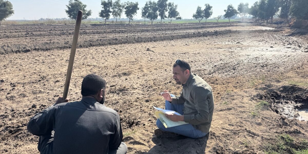
Field visits play a critical role in assessing land degradation risks and developing effective strategies for sustainable land management. While satellite imagery and remote sensing technologies provide valuable large-scale information, direct field observations remain essential for understanding local environmental conditions and identifying the underlying causes of land degradation.
Land degradation is a growing challenge in many parts of Iraq, particularly in agricultural areas exposed to water scarcity, soil salinity, desertification, and climate change. Field assessments enable experts and environmental practitioners to collect first-hand data on soil quality, vegetation cover, erosion patterns, water availability, and land-use practices. These observations provide a more accurate picture of the environmental pressures affecting local ecosystems and agricultural productivity.
During field visits, specialists engage directly with farmers and local communities to better understand the challenges they face and to document traditional land management practices. Such interactions help identify practical solutions that are both environmentally sustainable and socially acceptable. Local knowledge often provides valuable insights into long-term environmental changes that may not be visible through technical assessments alone.
In Central Iraq, field surveys have become increasingly important for monitoring areas vulnerable to desertification and declining agricultural productivity. By evaluating indicators such as vegetation loss, soil compaction, salinity levels, and irrigation efficiency, experts can determine the severity of land degradation and prioritize interventions where they are most needed.
The information gathered through field visits supports evidence-based decision-making and contributes to the design of targeted restoration measures. These may include the introduction of sustainable irrigation systems, rehabilitation of degraded lands, afforestation activities, soil conservation techniques, and climate-resilient agricultural practices.
Moreover, field assessments contribute to national and international efforts aimed at achieving Land Degradation Neutrality (LDN) and advancing the objectives of the United Nations Convention to Combat Desertification (UNCCD). Reliable field data strengthens environmental monitoring systems and helps track progress toward sustainable development goals related to land, water, food security, and climate action.
As environmental challenges continue to intensify, regular field visits remain an indispensable tool for understanding land degradation dynamics and promoting sustainable land management. Through scientific assessment, community engagement, and informed action, field-based monitoring can help protect natural resources and ensure a more resilient future for agricultural landscapes and rural communities